Sentinel 3 Overview
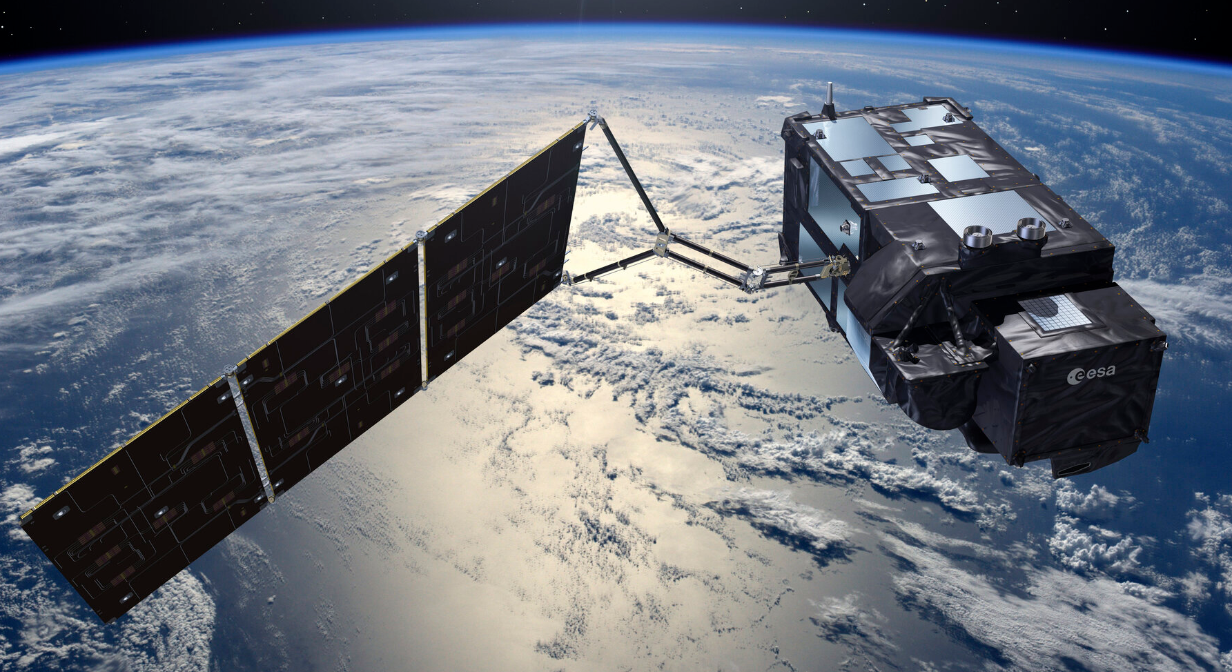
The Sentinel-3 satellites are part of the European Space Agency’s (ESA) Copernicus program, designed for Earth observation. These satellites monitor oceans, land, and the atmosphere, providing critical data for climate studies, environmental monitoring, and disaster response.
Instruments
Ocean and Land Colour Instrument
Sea and Land Surface Temperature Radiometer
Synthetic Aperture Radar Altimeter
Synthetic Aperture Radar Altimeter
Synthetic Aperture Radar Altimeter
OLCI Instrument (used for Imagery)
Key Features:
- 21 spectral band
- swath width of 1270 km
- spatial resolutions of 300 meters
Key Applications:
- Ocean Monitoring: Tracks phytoplankton blooms, water quality, and chlorophyll concentrations.
- Land Monitoring: Assesses vegetation health, soil properties, and land use.
- Atmospheric Studies: Monitors aerosols and atmospheric conditions affecting Earth’s energy balance.
SLSTR Instrument (used for Thermal Anomalies)
Key Features:
- Dual-View Capability - combines nadir (direct downward) and oblique (forward) views
- 9 thermal and optical channels
- High accuracy of better than 0.3 K for surface temperature measurements
- 1,400 km swath
- Day- and Nighttime Observations
Key Applications:
- Sea Surface Temperature (SST): Helps monitor ocean currents, marine ecosystems, and global climate patterns.
- Land Surface Temperature (LST): Tracks heatwaves, urban heat islands, and land-use changes.
- Fire Detection: Detects wildfires with dedicated thermal infrared channels (S6, S7, F1).
- nominal spatial resolution is 1km x 1km
- algorithms: (i) S7 = Standard and (ii) F1 = Alternative with low distortion
- Cloud and Aerosol Monitoring: Improves atmospheric analysis and climate models.
Orbit and Revisit Time
Sentinel-3 operates in a near-polar, sun-synchronous orbit at an altitude of approximately 815 km The satellites have a global coverage revisit time of two days for ocean monitoring and 1-4 days for land observations, depending on the instrument and location.
With two operational satellites, Sentinel-3A (launched in 2016) and Sentinel-3B (launched in 2018), they work in tandem to ensure better coverage and data continuity.
Revisit time over Europe
Example S3A Orbital Ground Tracks
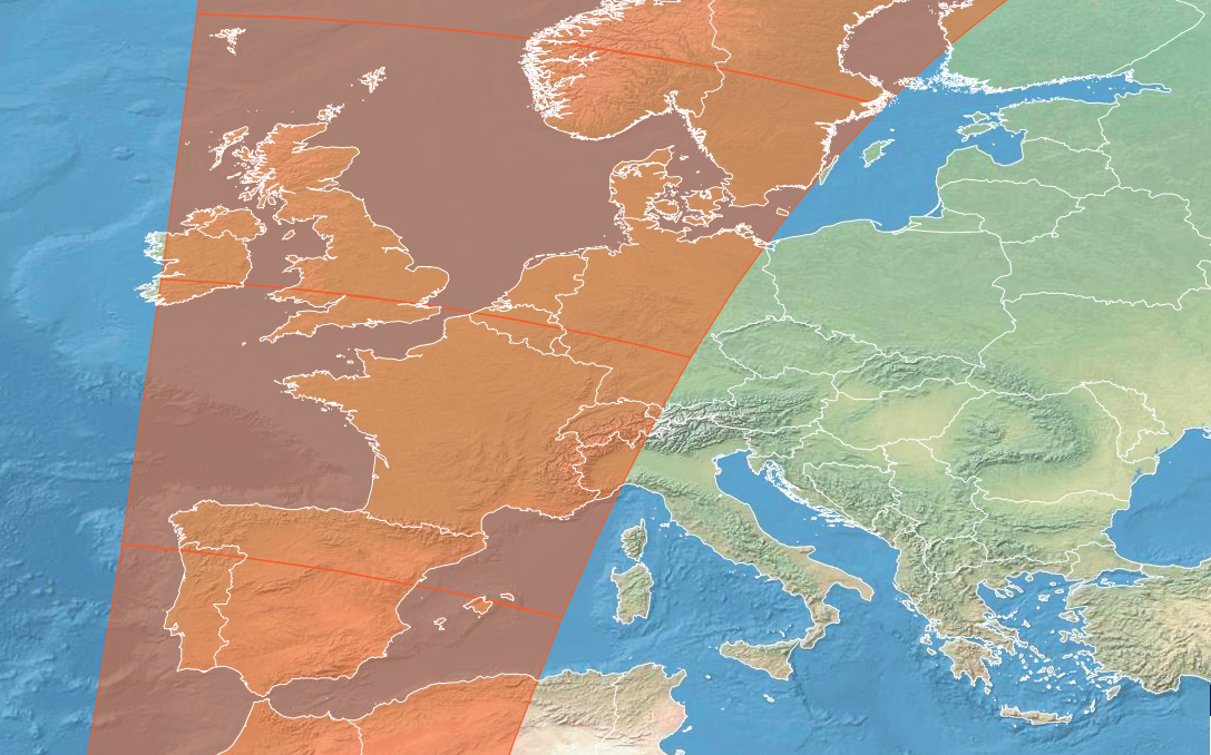 2024-12-22 09:48
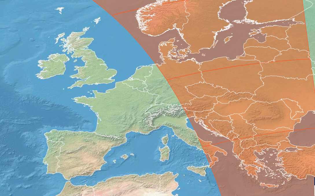 2024-12-22 19:54
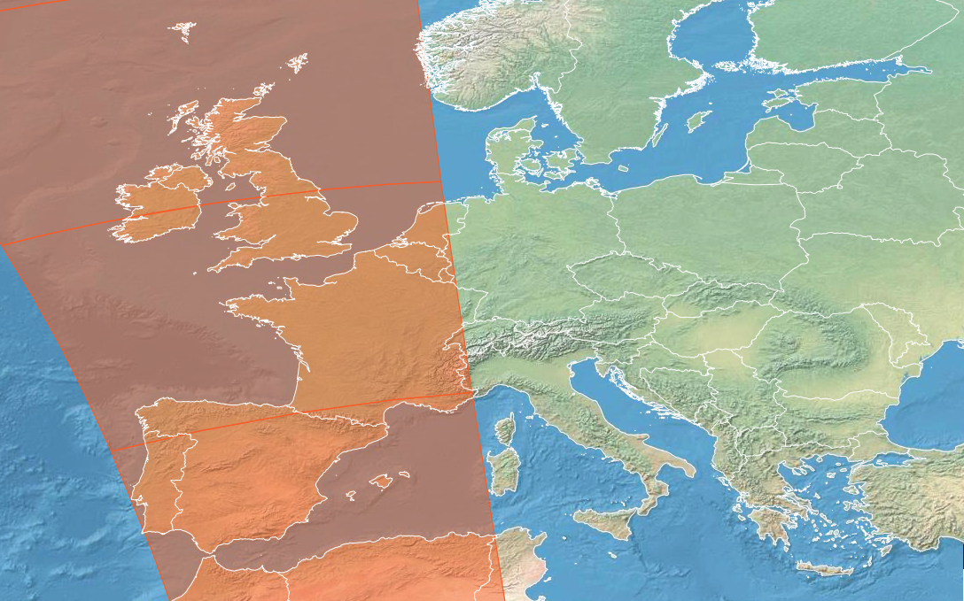 2024-12-22 21:35
S3 Thermal Anomalies (August & September 2024)
collected by Riscognition
More
Sentinel 3 Website: https://sentinels.copernicus.eu/web/sentinel/copernicus/sentinel-3
Orbit Tracks: https://view.eumetsat.int/productviewer?v=copernicus:sentinel3a_orbital_tracks
S3 SLSTR Channels: https://user.eumetsat.int/resources/user-guides/sentinel-3-slstr-level-1-data-guide
SLSTR NRT FRP: https://user.eumetsat.int/resources/user-guides/copernicus-sentinel-3-slstr-near-real-time-fire-radiative-power